Radars
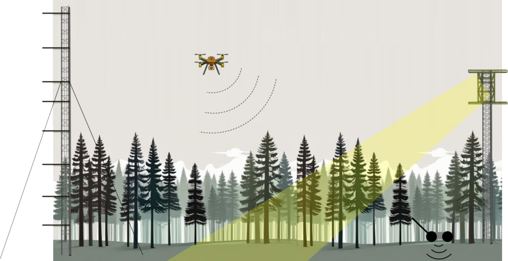
At SLU, we carry out extensive research on how radar remote sensing can be used for forest applications. We are currently developing one of the most advanced labs globally for studying the water exchange and evapotranspiration in trees, contributing towards the understanding and immediate monitoring of vegetation drought stress. A foundational part of the lab includes microwave imaging (radar), laser and spectral sensors, and a vast amount of water related sensors in trees, above and below ground. Together with Chalmers Technical University, a permanent radar tower (BorealScat-2) is used to measure backscatter changes in the canopy at sub-hourly frequency, year-round. By linking these measurements with data from drones, terrestrial, handheld, and other mobile platforms, the fundamental functioning of trees’ water systems can be scrutinized.
Radar or more commonly synthetic aperture radar (SAR) is an imaging technique based on electromagnetic waves that are emitted from an active sensor through an aperture (antenna), which are scattered towards objects and eventually recorded by an antenna. Monostatic setups use the same transmitting and receiving antenna, hence measuring the backscatter, while a bistatic setup uses one transmitting antenna and a separate receiving antenna. The wavelength a radar operates at is organized into bands, which simply put are different parts of the electromagnetic spectrum. For forest applications, the P-, L, C- and X-band (corresponding to wavelengths ranging from approximately 80 cm down to 3 cm) have so far been most used and researched. In contrast to a laser scanner (lidar), the radar emitted beams are relatively wide and scatter towards multiple objects at the time. It uses a side-looking geometry which often correspond to look angles of about 30-50 degrees to achieve range resolution.
Much of our work has focused on how different wavelengths interact with various forest and vegetation in order to derive biomass, volume, and height information from the forest. This has typically resulted in maps representing wall-to-wall predictions, which can be updated at higher temporal frequencies than maps based on other remote sensing techniques – such as lidars or optical sensors. This is due to the active sensor in SAR operating at a wavelength that enables it to penetrate clouds and rain, and hence acquiring data at higher temporal frequencies only limited by the platform carrying the sensor. We have worked extensively with sensors like ALOS-2 PALSAR-2, TanDEM-X, Sentinel-1, CosmoSkyMed, Radarsat, SAOCOM, LORA, Carabas and more.
Basic radar research
As a way to better understand the causality of the radar measurements and the forest properties causing them, we have invested more and more in research closer to the ground, as a means to increase the spatial resolution, be in better control of the circumstances under which the measurements are done, and to collect consistent and long time series of data. This also enables us to connect the radar research with other sensors, both remote sensing sensors and other types.
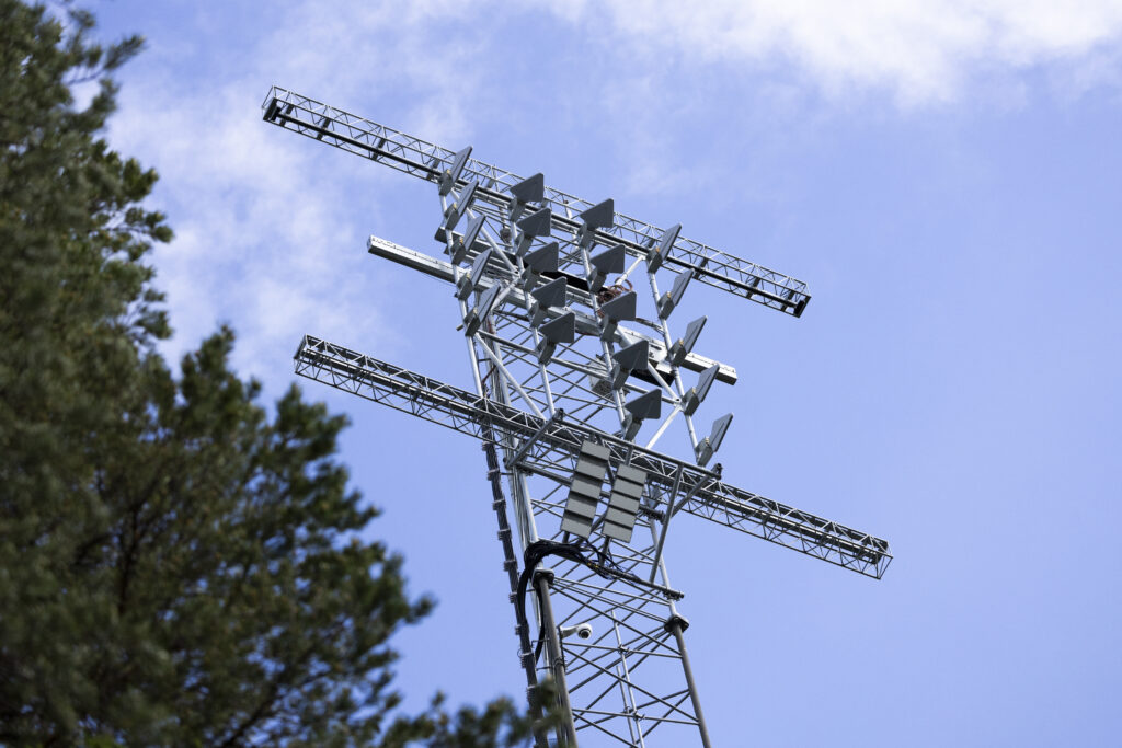
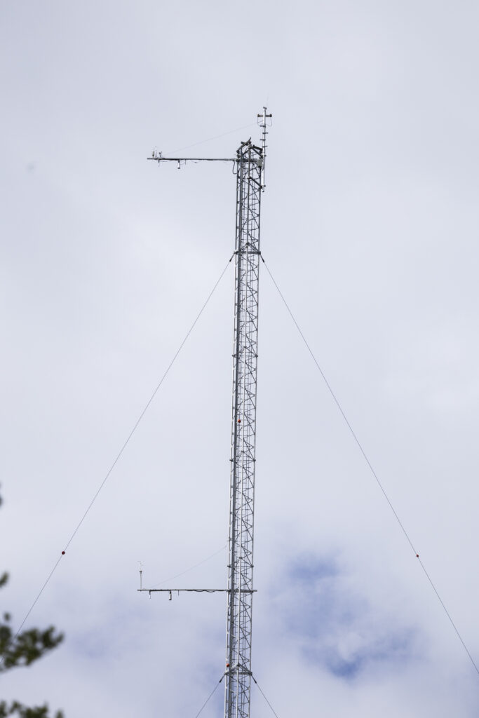
One part of this is the super test site at the Svartberget research station, located 1h outside of Umeå, where we have a unique infrastructure for forest research. Some of the core components making it unique are the BorealScat-2 radar tower, which is a 50 m tall tower carrying a radar system at the top that enables P-, L-, C- and soon also X-band SAR measurements. Nearby, the 150 m high ICOS mast collects air-quality and radiation measurements used for forest ecology research at scale. Furthermore, we collect ground-penetrating radar transects, drone-based SAR measurements, terrestrial and airborne lidar, moisture measurements, dendrometer data, weather data etc. from the site.
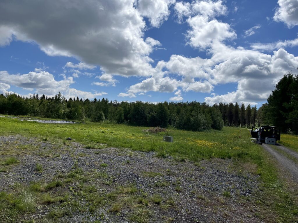
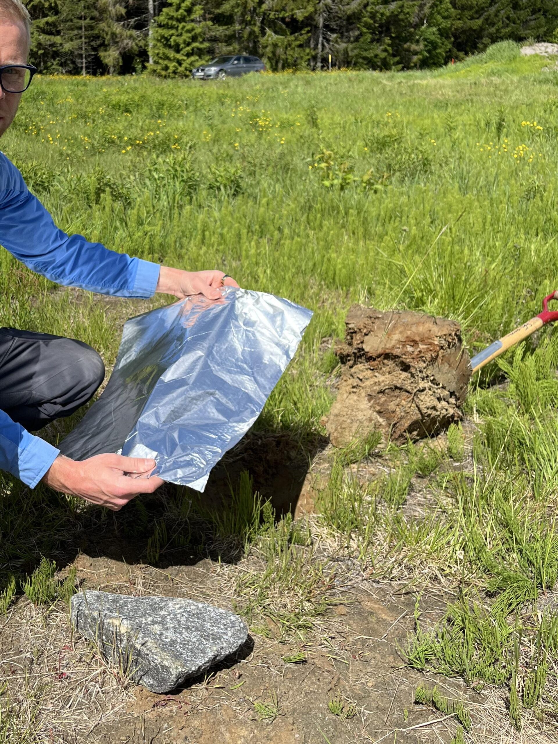
Radar campaigns 2024
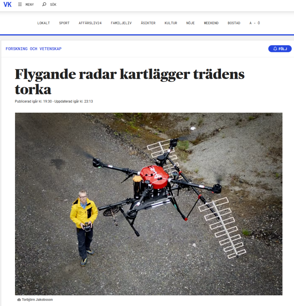
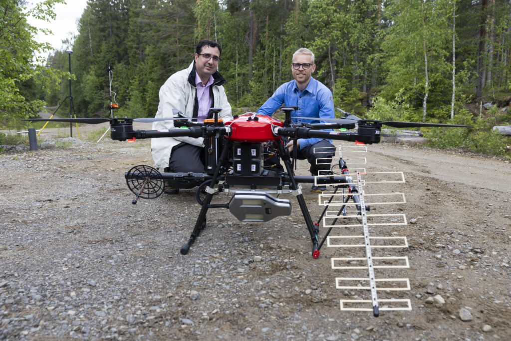
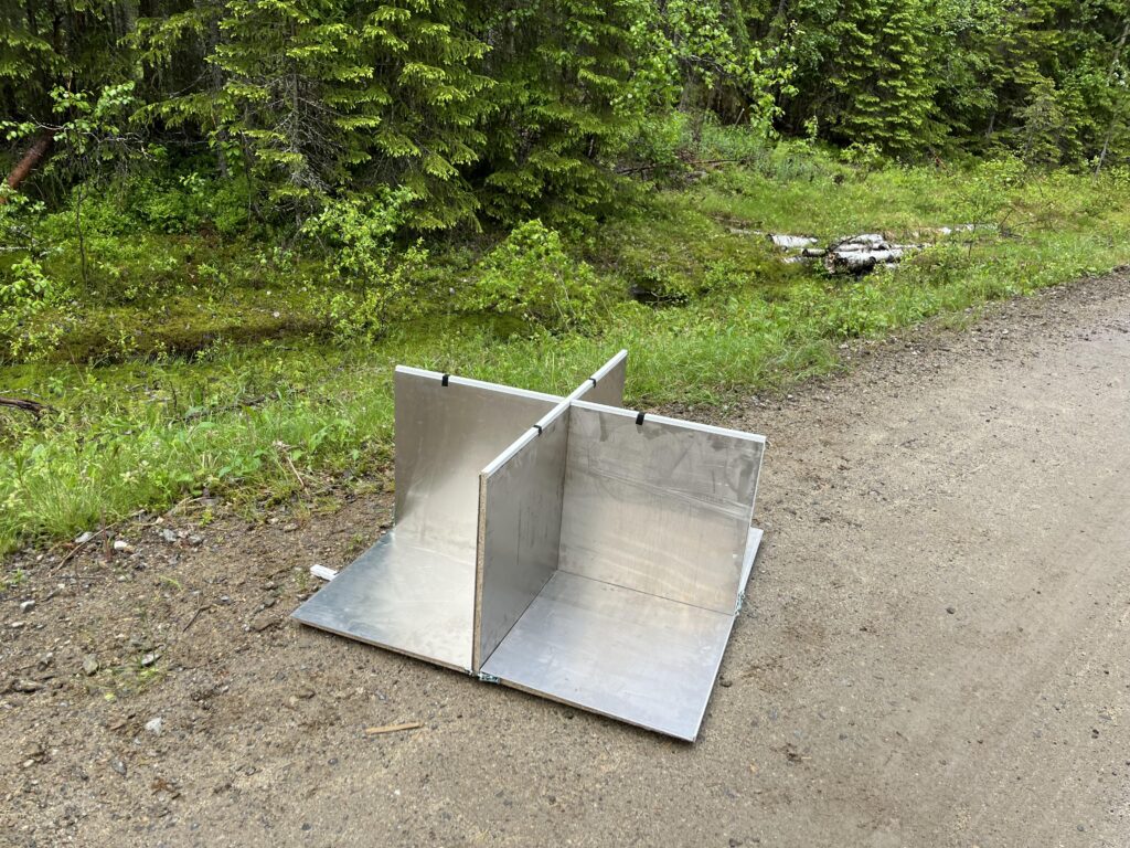
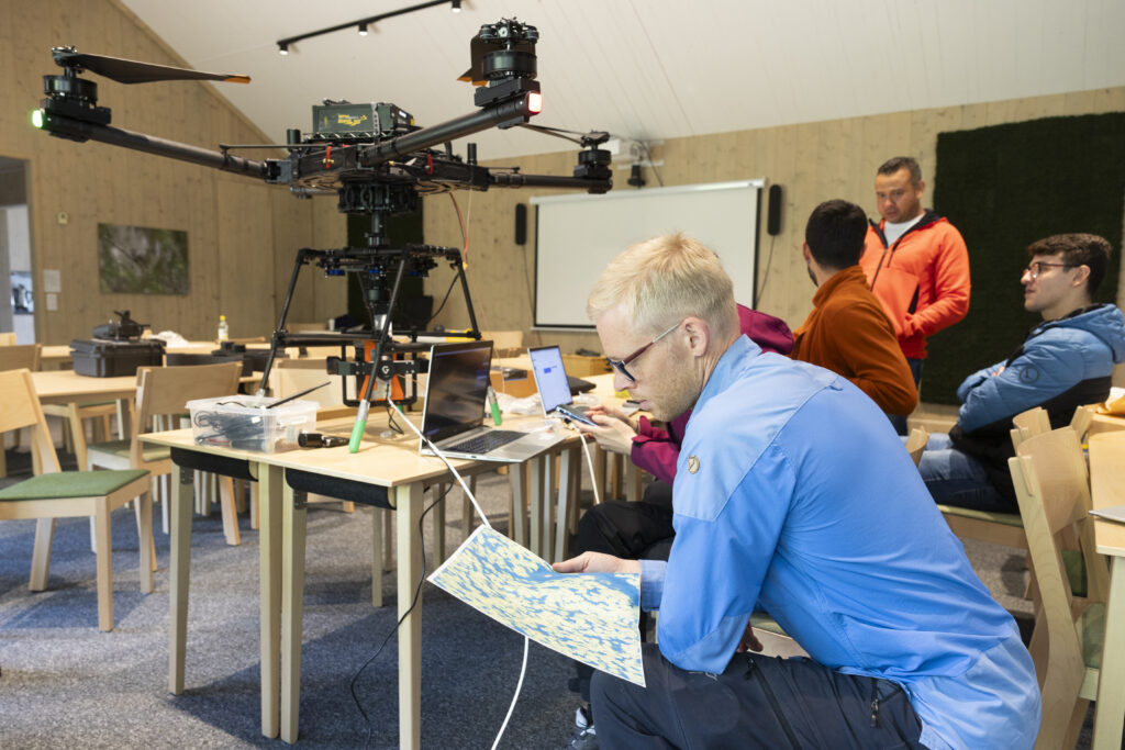
The first field campaigns with drone based radar, ground-penetrating radar (GPR), and tower based radar measurements for tree and sub-soil measurements have been completed during June, August and October 2024.
At Svartberget research station


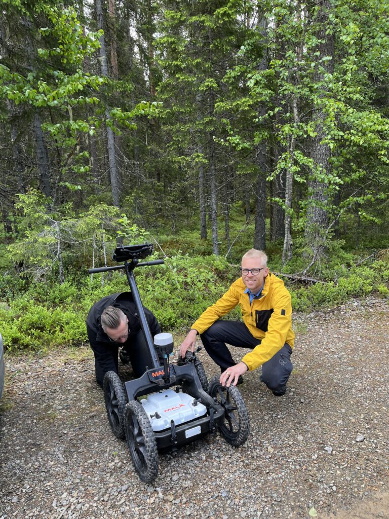
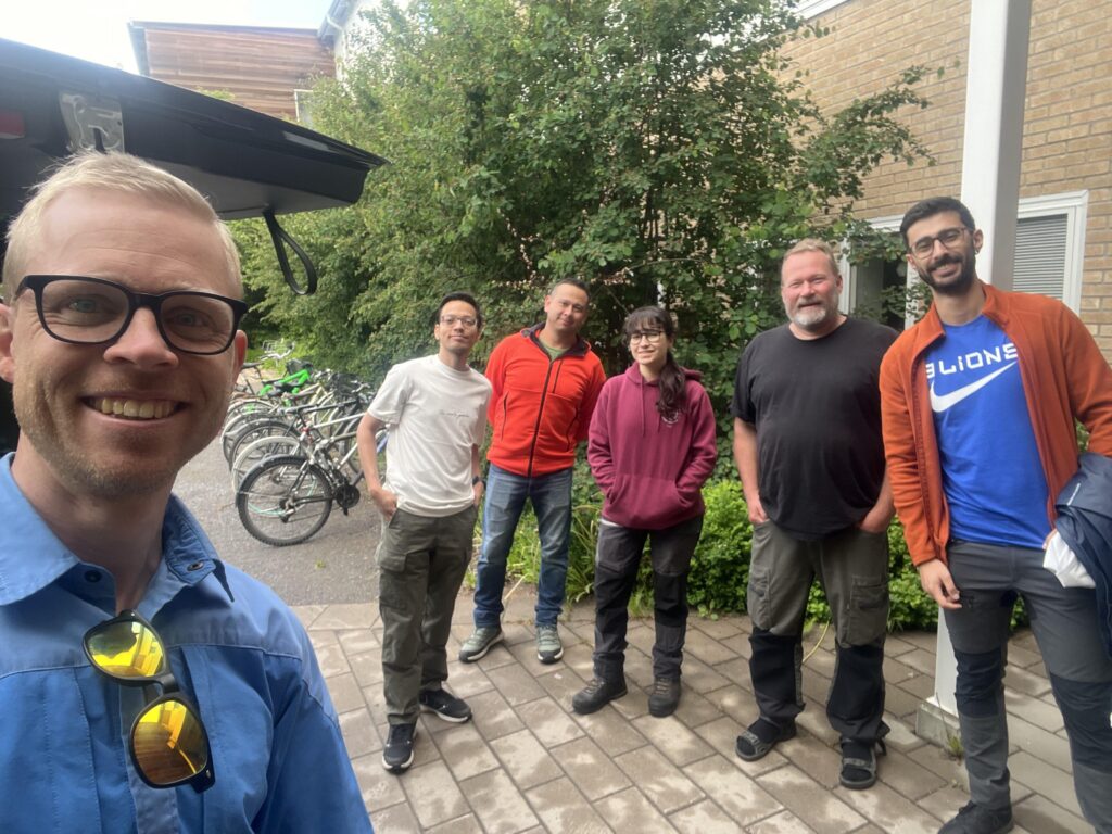
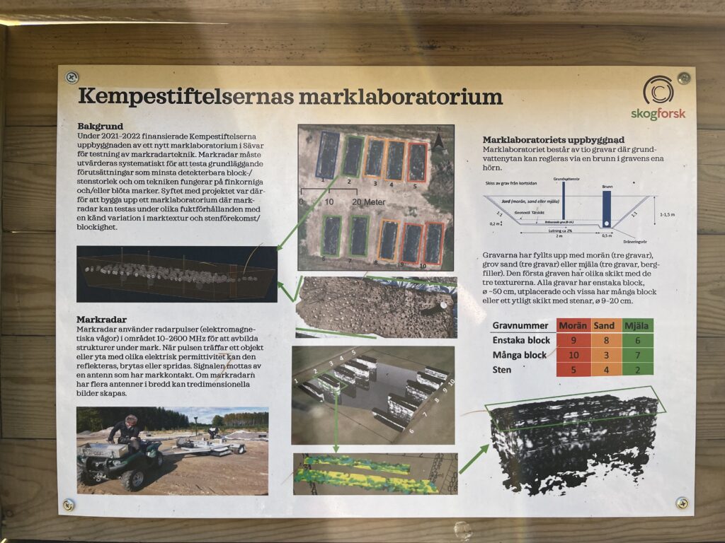
At the soil lab at Skogforsk research institute in Sävar
BorealScat-2 radar tower